Bat Ears Picture of the Week

A couple of weeks ago, I drove to a part of Arizona that I hadn’t seen before. I knew about Alamo Lake as a fisherman but never went there because it wasn’t stocked with trout, and the fishing reports always warned about rattlesnakes. That was enough to put me off. But, during our club’s spring classes, one of the students brought in photos from the Alamo area that I found so interesting that I changed my opinion about visiting the La Paz County lake.

She took photos east of the lake, where Date Creek cuts through an ancient mud deposit. Because of how the intermittent water has eroded the soil, the place is known as Mud Cliffs. It’s not shown on any maps I have, but I knew it was the general area, so I left the house with enough time to explore and still have a couple of hours to shoot before sunset.

From Wenden, the paved road to Alamo State Park runs due north. It has little or no traffic, and it only took me an hour to get to the park store. When I asked the friendly staff inside about the cliffs, the host handed me a hand-drawn map. “Head toward Wenden to the Wayside Road, then jog over to Palmerita Road and follow it north.”

“Thanks,” I said as I took the map and paid too much for a Butterfingers candy bar and the park’s day fee—even though I was leaving.

During the classes, my student said her group was out on ATVs, but she believed you could get there by car. She was right. All the roads were wide and well-graded, and when I drove them, they didn’t have a lot of washboards. After I reached the spot on the map, I searched for the canyon shown in her pictures, and when I found it, I spent an hour or so hiking and shooting the photos that I’ll be sharing this month—I guess it’s Alamo Lake Month.
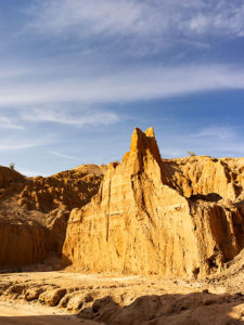
Bat Ears
An erosion formation at the head of the slot canyon glows in the late afternoon sun. The pair of points on top reminded me of a bat or maybe even Batman.

This week’s image is called Bat Ears, and I took it at the slot canyon’s mouth towards the end of the day. I passed it going in, but the sun didn’t have the same warmth as in this image, so it wasn’t interesting enough to shoot. The name comes from the pair of points at the top. This cliff doesn’t have a name—none of them do. Because the soil is so soft, it quickly erodes. A good flood will wipe out the existing landscape and replace it with new formations. The ears may not last another year, so I got to name a geological feature that—maybe—no one else will see. My chest swells with pride.

You can see a larger version of Bat Ears on its Web page by clicking here. I hope you enjoy viewing my new entry, and I hope you’ll tag along as I work my way up the canyon. It’s a pretty exciting hike.

Until next time — jw

The Shrine Under Yavapai Skies

Ask any Arizonan about Yarnell and they’ll most likely tell you about the horrible 2013 fire that swept through the town and the 19 hotshot firefighters that lost their lives when the fire trapped them, in an open field. It’s a big deal for us and to honor those men, Arizona built the Granite Mountain Hotshots Memorial Park. Someday I hope to show that park to you, but I must first build up my stamina to be able to complete the seven-mile round trip trail over a 1200’ elevation rise. For now, I want to talk about another Yarnell attraction that’s celebrating its 79th anniversary this year; The Shrine of Saint Joseph of the Mountains. I’m guessing it’s a place that even most Arizonans haven’t heard about.

As you travel north on Yarnell’s main street lined with antique shops, it’s very easy to miss Shrine Drive, a paved road on the east side barely wide enough for passing cars. The road winds through dappled shade of scrub oaks lining Harper Canyon. The pavement only lasts a half mile, and when it turns to dirt, it’s at the Shrine parking area. As you get out of the car, the first thing you notice is how quiet it is. Even the birds whisper. You don’t see much at first, but through the trees in front of you, seated at a table is a welcoming statue of Jesus.

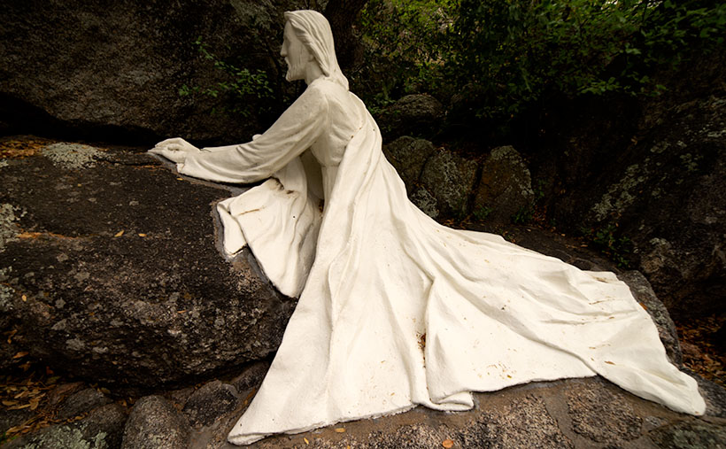
Praying Jesus
Praying Jesus – A statue depicting Jesus Praying is an example of Felix Lucero’s artwork at the shrine and makes a stop worthwhile.

The retreat (park, pilgrimage, or however you may interpret its purpose) was the concept of the Catholic Action League of Arizona in 1934. They worked on the plan for four years and contracted self-taught sculptor and unemployed dishwasher Felix Lucero who was living under the Congress Street Bridge in Tucson. Felix’s life is a story of its own and his other collection of work is in Tucson’s Garden of Gethsemane; now know as Felix Lucero Park. The shrine is a representation of the 14 Stations of the Cross—a ritual where Christians symbolically stop and pray at significant events that happened on Jesus’ crucifixion path. The stations at the shrine are along a stair pathway that climbs the mountainside culminating with a sculpture of Jesus on the Cross. Then you continue down the stairs past the last stations until you reach a sculpture representing the resurrection—a slab in an empty grotto draped with a shroud cloth.

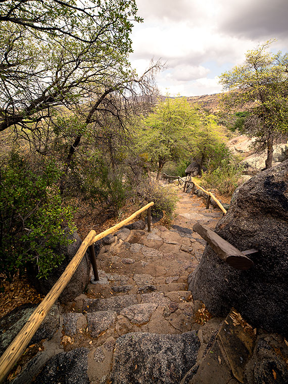
Stair Path
Stair Path – The stairs leading to the Stations of the Cross are often Steep. Considering that they already start at a moderate elevation, it’s not an easy journey.

The 2013 fire swept through the shrine site. It destroyed several of the support buildings, charred the trees, and completely burned some of the wooden station crosses. The fire burned away the crucifix on the hilltop completely leaving the sculpture of Jesus floating in the air suspended by bolts welded to a metal frame. Remarkably, the ivory colored statue was not damaged or discolored.

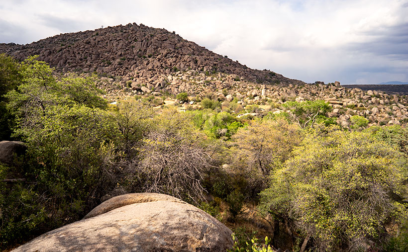
Shrine View – There are places along the path where the canopy opens revealing beautiful views of the surrounding countryside.

I went to Catholic school for four years and that was enough to cure me of organized religion, but as an artist, I enjoy the architecture of churches and the paintings, sculptures, and stained glass within them. I think that’s why I enjoy places like this shrine. I can see the thoughtful planning, hard work, and attention to detail found here. Besides, as you near the top, the tree canopy opens, and you have wonderful views of Yarnell and the Weaver, Bradshaw, and Granite mountains.

The next time you’re traveling the back road to Prescott, I recommend you spend some time visiting The Shrine of St. Joseph in Yarnell. If nothing else, walking the stations is good exercise. Let me warn you that your starting elevation is 4700’ and the stairs are steep. It’s almost a rock scramble; bring water. You’ll enjoy the art, the views, and the serenity. There’s no charge but there is a donation box that you’re welcome to use.

Until next time — jw